
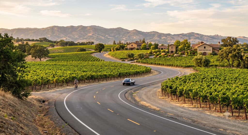
Highway 29 gets the postcard shot and the Saturday afternoon backup behind a tour bus outside Oakville Grocery. One ridge east, the Silverado Trail carries the same view of Cabernet vines climbing toward the Vaca Mountains, minus the traffic. This scenic drive runs a straight 29 miles from downtown Napa to Calistoga, and it is the road locals actually use when they want to cover ground in this valley without losing twenty minutes to a stoplight. Below is the Silverado Trail broken into stop-by-stop segments, with winery picks, harvest-season timing, cycling notes, and the cross streets that get you back to Highway 29 when you need them.
Why Drive the Silverado Trail Instead of Highway 29
Highway 29 was built for a smaller Napa Valley. Today it carries nearly all the valley’s tour vans, limos, and rental cars through Yountville, Oakville, and St. Helena, and by midafternoon on a summer Saturday it can take longer to drive five miles than it should. The Silverado Trail runs the full length of the valley on the east side, hugging the base of the hills, with two lanes, wide shoulders, and none of the stoplight clusters that back up Highway 29 through the town centers.
The wineries are not a consolation prize either. Some of the most decorated Napa Valley wineries sit directly on this road, and several of the valley’s best-known names built their reputations here specifically because the Stags Leap District soil and the Trail’s eastern exposure produce a distinctive style of fruit. If you would rather hand off the driving and tasting logistics entirely, a private wine tour can run this same route without anyone behind the wheel needing to spit.
Napa to the Stags Leap District: The First Six Miles
The Trail picks up the Stags Leap District almost immediately north of downtown Napa, and this six-mile stretch is the densest concentration of well-known names on the entire route.
Darioush, at 4240 Silverado Trail, is the one you will recognize from the road before you recognize the name: a row of freestanding limestone columns fronts the tasting room, a nod to owner Darioush Khaledi’s Persian heritage. The estate pours mostly Cabernet and Cabernet-based blends, and tastings run by reservation in a building that looks more like a small museum than a winery.
Clos du Val, at 5330 Silverado Trail, has been making wine here since 1972 and still keeps a low, unfussy profile compared to its neighbors. The picnic grounds under the oak trees are some of the best in the valley for an unhurried lunch between tastings.
Stag’s Leap Wine Cellars, at 5766 Silverado Trail, is the estate that put this stretch of road on the international map. Its 1973 Cabernet beat top Bordeaux at the 1976 Judgment of Paris, a result the valley is marking with anniversary events this year, and the tasting room still leans on that history without overplaying it.
Pine Ridge Vineyards, at 5901 Silverado Trail, digs its caves directly into the hillside, and the cave tour paired with a seated food-and-wine tasting is one of the better structured experiences on this end of the Trail if you want more than a bar pour.
The Yountville Cross Road Detour: Cliff Lede and a Shortcut to Highway 29
Just past Pine Ridge, Yountville Cross Road cuts west off the Silverado Trail and lands you directly in downtown Yountville, four minutes from Highway 29 and the restaurant row that includes The French Laundry.
Cliff Lede Vineyards sits right on that cross street at 1473 Yountville Cross Road. The estate is known as much for its rotating contemporary art collection displayed throughout the property as it is for its Stags Leap District Cabernet, and the reserve tasting is worth booking ahead if art is part of the draw for you.
This is also the easiest place on the drive to bail out to Highway 29 without backtracking. Keep the other connector streets in mind for the rest of the route:
- Trancas Street and Oak Knoll Avenue near the Napa end
- Rutherford Cross Road (Highway 128) around the midpoint
- Zinfandel Lane near St. Helena
- Lincoln Avenue as you roll into Calistoga
Any of these will bounce you between the two parallel roads in under ten minutes.
Rutherford’s Bubbly and Big Cabs: ZD Wines and Mumm Napa
North past Yountville, the Trail enters the Rutherford appellation, known in Napa Valley circles for a mineral quality winemakers still argue about, generally shorthanded as “Rutherford dust.”
ZD Wines, at 8383 Silverado Trail, is still run by the family that founded it in 1969, and the estate pours both Cabernet and a Chardonnay that built the winery’s early reputation, in a tasting room that feels closer to a family living room than a production facility.
Mumm Napa, at 8445 Silverado Trail, is the Trail’s sparkling wine stop, with an outdoor terrace built for lingering over a flight and a rotating photography gallery on the property that has featured Ansel Adams prints. It is one of the few tasting rooms on this stretch that welcomes walk-ins without much fuss.
St. Helena’s Detour and the Trail’s Final Miles to Calistoga
Joseph Phelps Vineyards sits about a third of a mile off the Trail on Taplin Road, just south of St. Helena, and it is worth the short detour. This is the estate that created Insignia, one of the wines credited with proving Napa could produce Bordeaux-style blends worth the price of the real thing, and the hillside tasting terrace looks back over the valley floor.
From there, the Silverado Trail continues north through increasingly rural, wooded terrain before dead-ending into Calistoga, where the wine tasting gives way to mud baths and hot springs if you want to end the day loosening up rather than driving back.
Driving the Silverado Trail During Harvest Season
Late August through October is when this drive earns its keep. Vineyard leaves start turning gold and rust along the Trail well before the valley floor catches up, crush crews work the fall grape harvest around the clock at wineries you will pass, and the air carries a faint fermenting-grape smell that does not happen any other time of year. It is also the valley’s most expensive and most crowded stretch, so book winery reservations and lodging early if you are planning an autumn drive.
Cycling the Silverado Trail
Road cyclists treat this route as one of the best rides in Napa Valley, and for good reason: wide paved shoulders run nearly the entire 29 miles, elevation gain is gradual rather than punishing, and traffic volume stays far lower than on Highway 29. Most riders tackle it as an out-and-back from downtown Napa or Calistoga rather than a one-way point-to-point, and e-bike rentals from shops around Napa and Yountville make the full distance manageable even if you are not training for anything.
Frequently Asked Questions
How long does it take to drive the Silverado Trail?
Driving the full 29 miles from Napa to Calistoga without stopping takes about 45 minutes. Budget 45 minutes to an hour per winery stop if you plan to taste, which turns a full stop-by-stop drive into a six-to-eight-hour day with three or four wineries.
Is the Silverado Trail less crowded than Highway 29?
Generally yes. Highway 29 carries most of the valley’s tour traffic through Yountville, Oakville, and St. Helena, while the Silverado Trail’s wider shoulders and fewer stoplights keep traffic moving even during peak season.
Can you bike the entire length of the Silverado Trail?
Yes. The route has wide paved shoulders and manageable elevation change for nearly its full 29 miles, and it is a popular out-and-back ride for both road cyclists and e-bike riders.
Do Silverado Trail wineries require reservations?
Most do, especially smaller estates like Darioush and Cliff Lede. Larger stops such as Mumm Napa tend to accommodate walk-ins more easily, but calling ahead during harvest season is smart everywhere on this route.
What is the best time of year to drive the Silverado Trail?
The Trail is a good drive year-round, but late August through October brings dramatic vineyard color and harvest activity, while spring offers mustard bloom in the vine rows and noticeably thinner crowds.
How do you get from the Silverado Trail back to Highway 29?
Several cross streets connect the two roads, including Trancas Street, Oak Knoll Avenue, Yountville Cross Road, Rutherford Cross Road (Highway 128), Zinfandel Lane, and Lincoln Avenue in Calistoga.
This drive rewards going slow. Pair it with a longer stay using a full Napa itinerary, and save at least one afternoon for the Stags Leap District stretch alone, since that six-mile run holds enough history and wine to fill a day on its own.